

Geodetic Survey RTK GPS receiver for sale
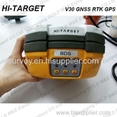
The V30 GNSS RTK system is designed to meet high quality standards at an affordable price. It is outstanding in its class, with a rugged design and user-friendly functions.
*Specification of the RTK GPS receiver:
• 220 Channels
• Advanced Pacific Crest Maxwell 6 Custom Survey GNSS Technology
• High precision multiple correlator for GNSS pseudo range measurements
• Unfiltered, unsmoothed pseudo range measurements data for low noise, low multipath error, low time domain correlation and high dynamic response
• Very low noise GNSS carrier phase measurements with<1 mm precision in a 1 Hz bandwidth
• Signal-to-Noise ratios reported in dB-Hz
• Proven Pacific Crest low elevation tracking technology
Satellite signals tracked simultaneously
GPS: Simultaneous L1C/A, L2C, L2E, L5
GLONASS: Simultaneous L1C/A, L1P, L2C/A (GLONASS M only), L2P
SBAS: Simultaneous L1 C/A, L5
Galileo: Simultaneous L1 BOC, E5A, E5B, E5AltBOC
BDS: B1, B2
QZSS: L1 C/A, L1 SAIF, L2C, L5
Accuracy of the geodetic survey RTK GPS receiver:
Static and Fast Static GNSS surveying
Horizontal: 2.5mm+0.5ppm RMS
Vertical: 5mm+0.5ppm RMS
Post Processing Kinematic
(PPK / Stop & Go) GNSS surveying
Horizontal: 1cm+1ppm RMS
Vertical: 2.5cm+1ppm RMS
Initialization time: typically 10 minutes for base while 5 minutes for rover
Initialization reliability: typically > 99.9%
RealtimeKinematic(RTK) surveying
Horizontal: 8mm+1ppm RMS
Vertical: 15mm+1ppm RMS
Initialization time: typically < 8 seconds
Initialization reliability: typically > 99.9%
Code Differential GNSS positioning
Horizontal: 25cm+1ppm RMS
Vertical: 50cm+1ppm RMS
SBAS: 0.50m Horizontal, 0.85m Vertical
Hardware Information:
Physical
Dimensions (W x H): 19.50cm x 10.40cm(7.68 in x 4.09 in)
Weight: 1.3kg (2.86lb) with internal battery, internal radio, standard UHF antenna
Operating temperature: -45℃to +65℃ (-49℉ to +149℉)
Storage temperature: -55℃ to +85℃ (-67℉ to +185℉)
Humidity: 100%, considering
Water/dustproof: IP67 dustproof, protected from temporary immersion to depth of 1m (3.28ft).
Shock and Vibration: Designed to survive a 3m(9.84ft) natural fall onto concrete.
Electrical
Power 6V to 28V DC external power input
Power consumption 2.5W
Automatic Switching between internal power and external power
Rechargeable, removable 7.4V, 5000mAh Lithium-Ion battery in internal battery compartment
Internal battery life
Static 13 - 15 hours
RTK Rover (UHF/GPRS/3G) 10 - 12 hours
RTK Base 8 - 10 hours
I/O interface
1 x Bluetooth
1 x standard USB2.0 port
2 x RS232 serial port
2 x DC power input (8-pin & 5-pin)
*Contact US: